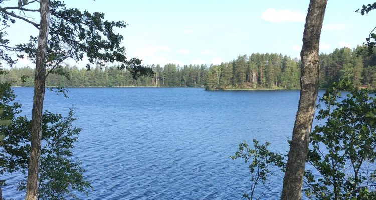
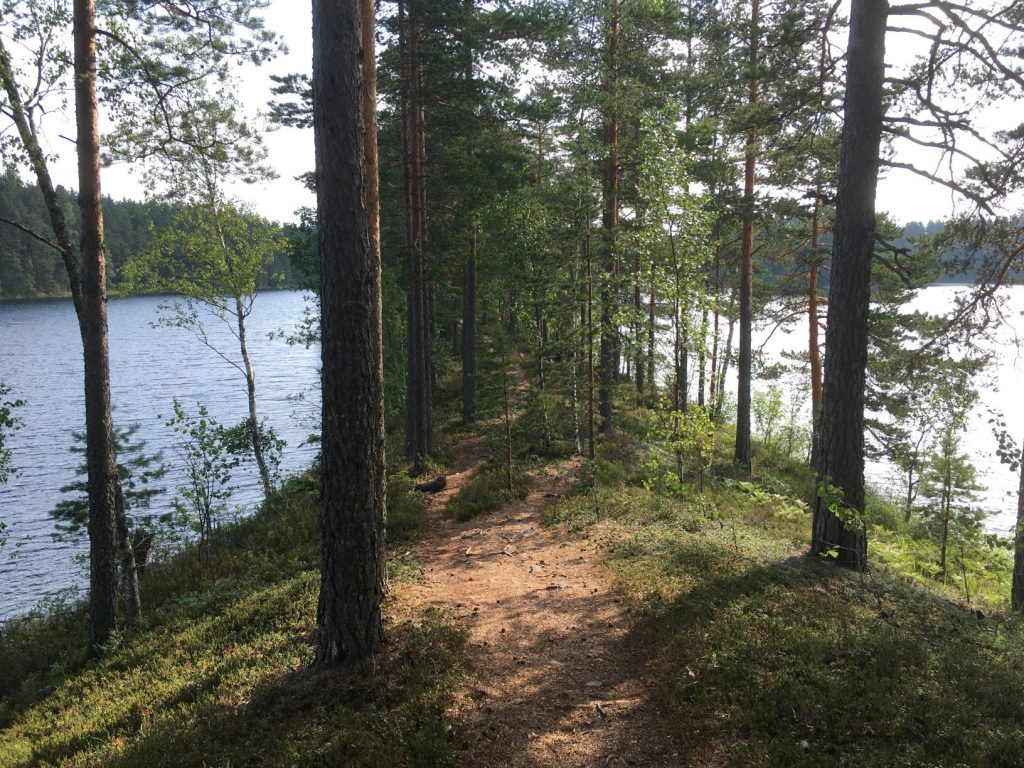
Lake Iso-Melkutin is a popular scuba-diving destination in Southern Finland because of its clear water and underwater ridge. It’s also a beautiful hiking and trekking area where I like to go at least once every summer. The trail around the lake is about 7 kilometers long and easy to follow.
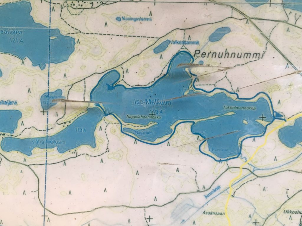
The Iso-Melkutin is located in Räyskälä village in the municipality of Loppi. It has been created at the end of ice age and it reminds me of nearby Lake Pääjärvi, which is also located in the Häme Lake Uplands. When the ice was melting at the end of the ice age, it created a river delta where massive ice blocks were buried by sand and gravel. Lake Iso-Melkutin is believed to be created by one of those ice blocks eventually melting. Lake Vähä-Melkutin is like a little brother to Iso-Melkutin. This area, Melkuttimet lakes, is protected by Natura 2000 and two other programmes by the Finnish Ministry of Environment.
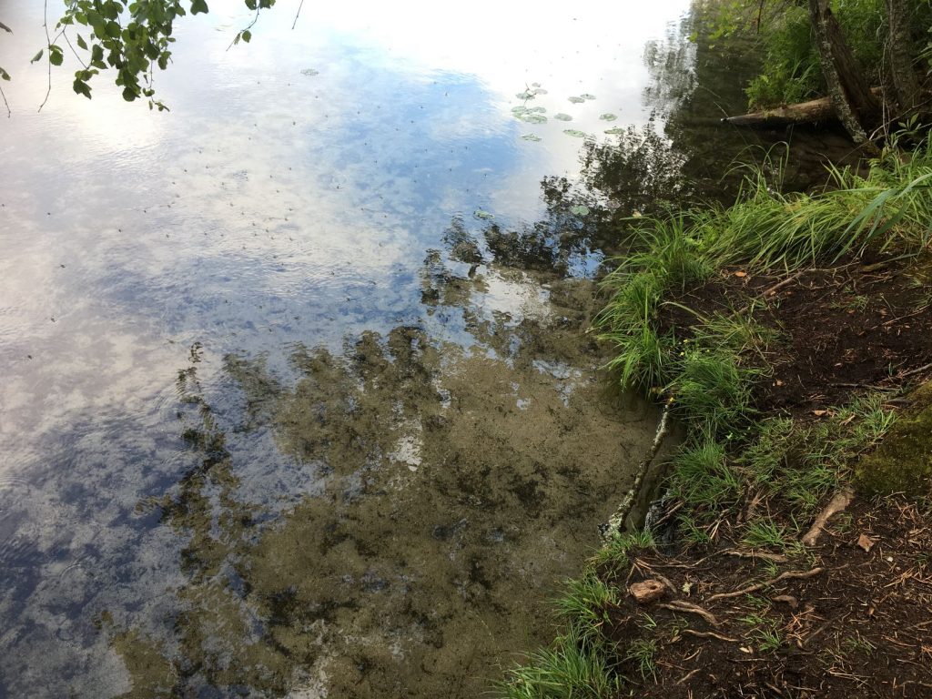
I have been picking blueberries and fishing at the Melkuttimet lakes and I would recommended it especially for families, because of the swimming and snorkeling opportunities. It is not so common for lakes in Southern Finland to have so clear water as these lakes have. If you sit by the lake, you might be able to see small fish or maybe frogs in it. For information about scuba-diving at the lake, get in touch with Riihimäen Urheilusukeltajat.
Somebody was calling for hiking buddies to Melkutin at one Facebook group for outdoor sisters, and I decided to go for a little day trip with few other ladies in May. We met at the parking lot and decided to walk around the lake anticlockwise, tackling the more uneven part of the trail with few little climbs first. There are snakes in this area, but we all decided to wear sneakers instead of hiking shoes as we knew we will be walking on the trail the whole time.
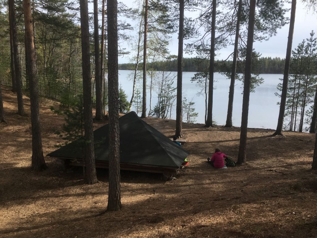
There are lots of pine trees, and the ridges opening to south are quite dry and therefore provide pretty harsh conditions for plants. It’s is quite unique growth environment and has some very rare plants and flowers such as beautiful blue Eastern pasqueflower. Little Tokholmannokka peninsula in the middle of the lake is a wonderful place to walk on or set a camp. We had a little break at the end of the peninsula, but decided to set fire and eat lunch at the second lean-to shelter. There are few other smaller peninsulas too.
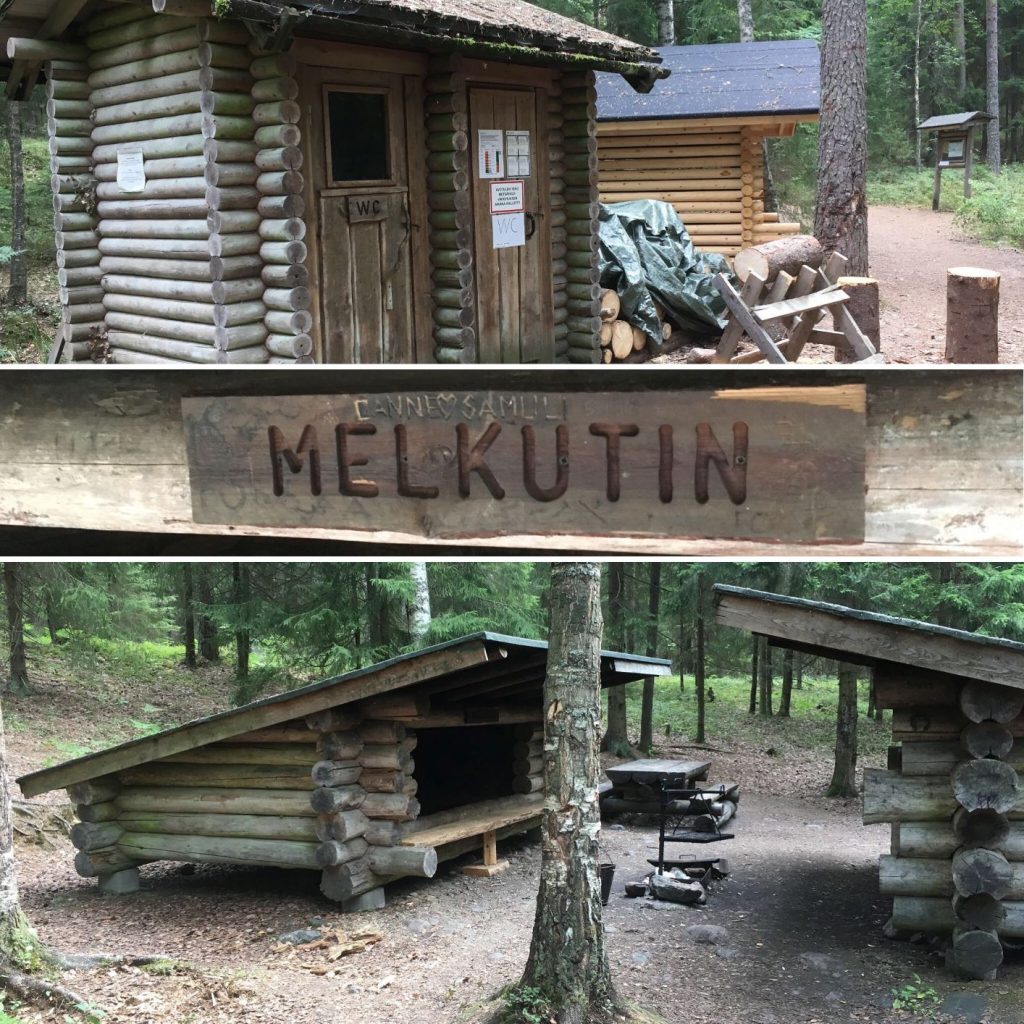
Trail and lean-to shelters at the Iso-Melkutin
There are two lean-to shelters and dry toilet facilities by the trail around the lake, one on the east end of the lake and another one on the west (see map below). Camping is allowed everywhere, but it is recommended that you stay close to the lean-to shelters. The eastern lean-to shelter is close to a shallow beach and only about 900 meters from the parking lot. It has big logs for firewood that you have to saw and cut yourself, because some idiots kept steeling the smaller firewood from the shelter. Fire can only be made in designated fireplaces (lean-to shelters), and only when the forest fire warning is not on. You can check that beforehand at the Finnish Meteorological Institute’s website. Everyman’s rights apply and you are allowed to fish with a worm fishing rod. For lure fishing you will need to purchase a permit.
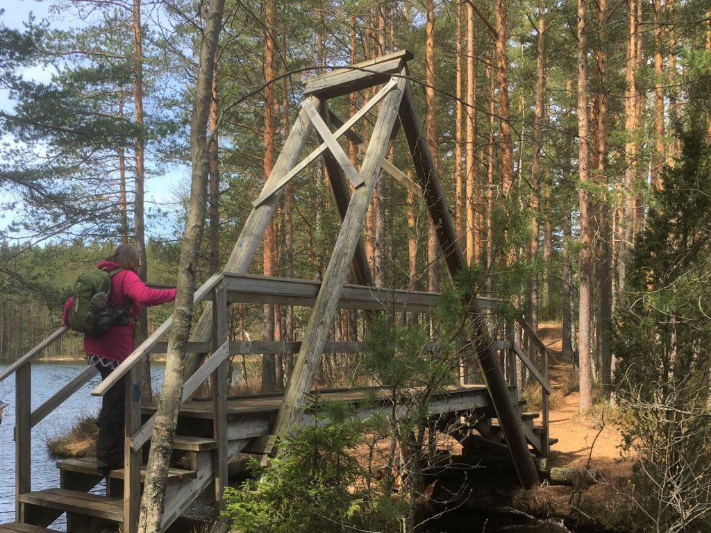
The trail around the lake is marked with blue marks on the trees, but you will be able to see the lake most of the time anyway. The trail is relatively easy but it has some intermediately challenging parts such as gradual climbs, small bridges and roots. The bridge over the little stream going from Vähä-Melkutin to Iso-Melkutin is a lovely sight. You can also hike around the smaller lake, but we didn’t go there, so I’m not sure about the condition of the trail.
For geocatchers: There are few geocaches in this area. Apparently one of them is a multi-cache that requires swimming, so I left those caches alone at this time of the year. It was a lovely day, but not warm enough for me to swim.
The second lean-to shelter in the western side of the lake is nicer than the first one. We had our lunch break here. This is probably the most popular place for camping around this lake, and already in May somebody had their hammocks set up nearby. The Melkuttimet lakes are pretty popular outdoor destination from spring to autumn, and it would be pretty rare if you didn’t see anyone else when walking here.
There are also lynx markings of Ilvesreitti (Lynx Trail) near Iso-Melkutin. They mean that you are able to do some long distance trekking also from this area. The trails can be accessed from Tauluntie parking lot, which is about 900 meters from the lake, on the east of it.
Directions
Address:
Tauluntie parking lot
Tauluntie 146
12820 Loppi
How to get there:
Car: Melkuttimet area is located in Loppi and Tammela municipalities. The small parking lot can be found in the address Tauluntie 146, Loppi. It is in the western corner of Räyskälä airfield. Arriving from main road 2 (Helsinki-Pori) you first turn to Hämeen Härkätie and after 18 kilometers to Tauluntie towards Räyskälä. The parking lot is about 3,7 kilometers from the Härkätie intersection along Tauluntie. Arriving from road 54 in the north east you should first turn to Rautakoskentie towards Räyskälä, turn to Räyskäläntie still towards Räyskälä, and then after the local grocery store and just before the airfield turn to Tauluntie. The parking lot is 1,4 kilometers from Räyskäläntie intersection.
Public transport: Buses travel along road 54 daily, but the closest bus stop (Vojakkala, Loppi) is over 8 kilometers away. Tickets and information: Matkahuolto.
Bicycle: The Häme Härkätie Road cycling route is not far from Iso-Melkutin as it’s going along the Härkätie Road in approximately 4 kilometers away. For more information about cycling the Härkätie Road, I recommend a map called Fillariopas Härkätietä itään (Cycling guide East along Härkätie Road). That map includes information in Finnish, English and German for cycling between the cities Turku, Hämeenlinna, Lahti, and Kouvola. It’s available in various online stores.
When to visit: Melkuttimet lakes are attracting visitors especially during the summer months, from June to August.
Accessibility: There are no services for the disabled in the area, but the area is suitable for families with children. The eastern lean-to shelter is easilly accessible from the parking lot.
Also visit in the area
The Iso-Melkutin is absolutely worth the 1,5 hours drive from Helsinki, and this area is packed with many beautiful sites to visit.
- Pääjärvi recreation area is also part of the Häme Lake Uplands and located nearby.
- The Korteniemi Heritage Farm is part of the Liesjärvi National Park and Häme Lake Uplands. It showcases the history of the farming in Finland and it is a lovely place to visit during summer. Kyynäränharju is a beautiful ridge in Liesjärvi.
- Ruostejärvi is fun nature destination for kids in Tammela. It has a popular beach during summer and many short nature trails to explore.
- Saari Folk Park is known for its ridges, lakes and sandy shores. Old and charming Kaukolanharju observation tower at Saari Folk Park welcomes visitors during summer months.
- Torronsuo National Park is also located in Tammela. Torronsuo is known as being Finland’s deepest bog. Camping at Torronsuo is not allowed, but there are few circle trails on the duckboards as well as few birdwatching towers and fireplaces available.